To illustrate the advantages of mapping with drones we decided to acquire imagery of an active beaver habitat to highlight historic beaver dams and lodges in a way that is not possible with satellite imagery. Recent beaver (Castor canadensis) habitat is often readily identified in satellite imagery but historic activity is often not. Identifying older and less visible features can require extensive time on the ground which increases risks to field crews and costs to programs.
We found that cross-referencing customized orthoimagery and elevation models allows remote identification of features otherwise while minimizing time on the ground.
PROJECT DETAILS
A Corax flight team acquired imagery of the selected area of operations with a quadcopter drone and collected DGPS ground control points. We then processed the data with photogrammetry software to produce data products we thought would be useful for this study.
IMAGERY ACQUIRED: 5/30/2019
AREA MAPPED: 1.39 km2
IMAGES ACQUIRED: 1208 high-resolution jpeg
GROUND CONTROL POINTS: 7
ORTHOIMAGERY RESOLUTION: 2.99 cm/px
ELEVATION MODEL RESOLUTION: 12 cm/px
XYZ GEOREFERENCING ACCURACY:
PROCESS
We imported our custom elevation data and orthoimagery layers into GIS software over Google satellite imagery. The elevation data for the area of interest was cut into 17 smaller sections and a color ramp was added for each section to help visualize small elevation changes.
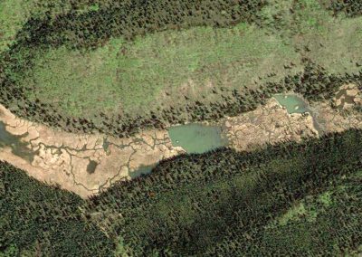
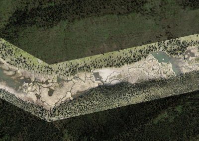
Google Earth imagery
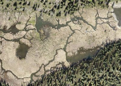
Custom orthoimagery
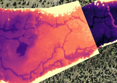
Digital elevation model with color ramp
Switching between the elevation data and orthoimagery allowed the visualization of features not visible in existing satellite data.
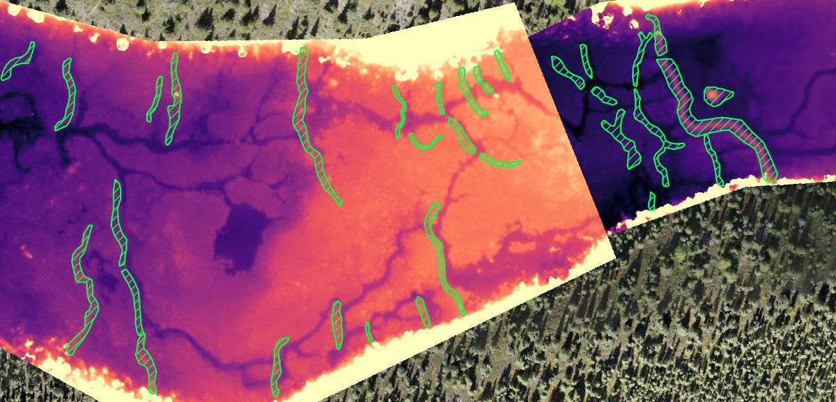
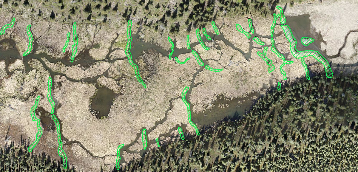
We then outlined all Castor canadensis features with polygons.
RESULTS
EAST AREA OF INTEREST
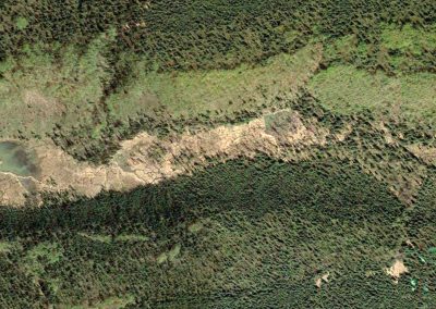
Google Earth imagery
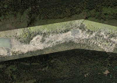
Corax orthoimage
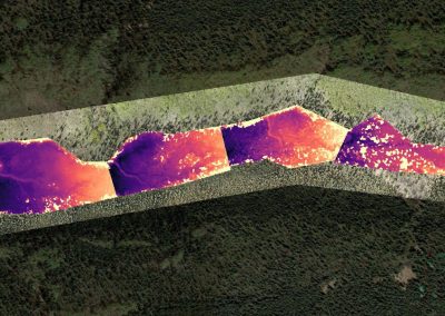
Corax elevation model
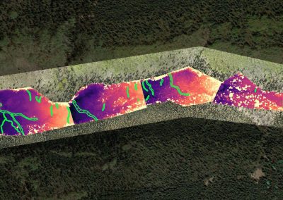
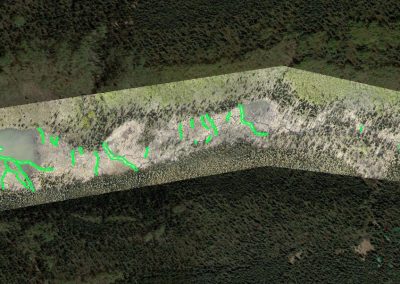
Corax elevation model with features ID'd
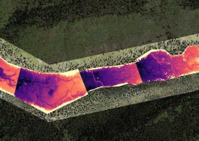
Corax orthoimage with features ID'd
CENTRAL AREA OF INTEREST
Google Earth imagery
Corax orthoimage
Corax elevation model
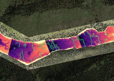
Corax elevation model with features ID'd
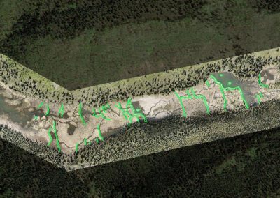
Corax orthoimage with features ID'd
WEST AREA OF INTEREST
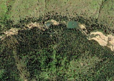
Google Earth imagery
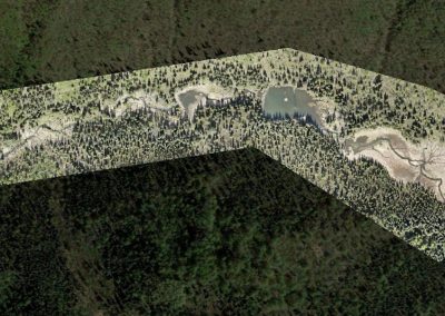
Corax orthoimage
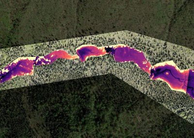
Corax elevation model
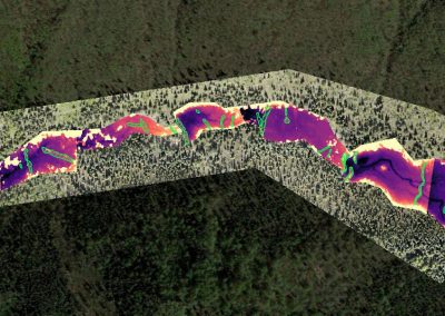
Corax elevation model with features ID'd
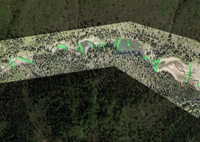
Corax orthoimage with features ID'd
DISCUSSION
Combining our custom orthoimagery and elevation data made habitat features visible that would have otherwise remained hidden due to overgrowth and the flooding and draining processes of new beaver activity.
Only features made obvious by our process were outlined for this study but the abundance of historic features led us to believe that there are still more to be identified. We plan to reacquire higher resolution imagery for more throughout the 2020 field season to quantify new beaver activity and possibly reveal more historic features.
14 CFR Part 107 certified
fully insured
DUNS #116982058
Alaskan owned and operated
(907) 242 7476 | PO Box 407 | Sutton, AK 99674
Recent Comments