The Monolith is a popular climbing destination in Alaska’s Hatcher Pass Management Unit. Located above treeline and a short walk from the Archangel Valley trailhead, the Monolith’s easy access and clean granite has been attracting rock climbers for over 30 years.
We were interested in exploring how computerized 3D modeling can aid in visualizing complex or difficult terrrain. In this case, we wanted to see how a 3D model of a popular rock climbing destination can make terrain data uniquely accessible.
Click & drag to zoom and rotate the model
Photogrammetry-produced models can be imported into any number of 3d modeling software programs for editing and sharing online. Cross-referenced with climbing route information from Kelsey Gray’s Alaska Rock Climbing Guide, our model provides a unique tool for visualizing and sharing terrain information.
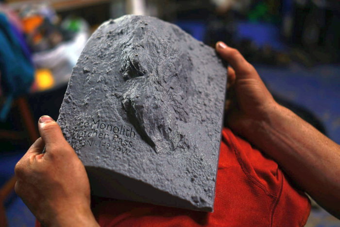
Our friends at Alaska Mountain Maps 3D-printed us a physical Monolith model to compliment the digital one.